Search found 180 matches
- October 27th, 2014, 10:52 pm
- Forum: Transportation
- Topic: Twin Cities Future Transit Map
- Replies: 377
- Views: 83387
- October 27th, 2014, 10:49 pm
- Forum: Transportation
- Topic: Twin Cities Future Transit Map
- Replies: 377
- Views: 83387
Re: Twin Cities Future Transit Map
yeah, it's on my to-do listCan you add the Penn/Van White circulator concept? It would be nice to see how that fits into the system.
- October 27th, 2014, 10:47 pm
- Forum: Transportation
- Topic: Twin Cities Future Transit Map
- Replies: 377
- Views: 83387
Re: Twin Cities Future Transit Map
A handful of trips each day go beyond 46th/Nicollet, but they loop around Washburn/Ramsey schools and don't go west to Lyndale/Bryant. I agree. With 5 daily trips, the 11 is basically a school route west of Nicollet. For the sake of simplicity, let's not show any school routes. Speaking of, the 11 ...
- October 24th, 2014, 12:58 am
- Forum: Transportation
- Topic: Twin Cities Future Transit Map
- Replies: 377
- Views: 83387

- October 24th, 2014, 12:19 am
- Forum: Transportation
- Topic: Twin Cities Future Transit Map
- Replies: 377
- Views: 83387
Re: Twin Cities Future Transit Map
future plan if the Service Improvement Plan were to be implemented:
https://forum.streets.mn/viewtopic.php?f=18&t=3263
Core bus = every 15 minutes or less

https://forum.streets.mn/viewtopic.php?f=18&t=3263
Core bus = every 15 minutes or less
- October 22nd, 2014, 6:18 pm
- Forum: Transportation
- Topic: Twin Cities Future Transit Map
- Replies: 377
- Views: 83387
Re: Twin Cities Future Transit Map
It would be possible to re-purpose this map to show today's services as well. Such 'backbone service' maps can be posted at rail stations and at transit centers.
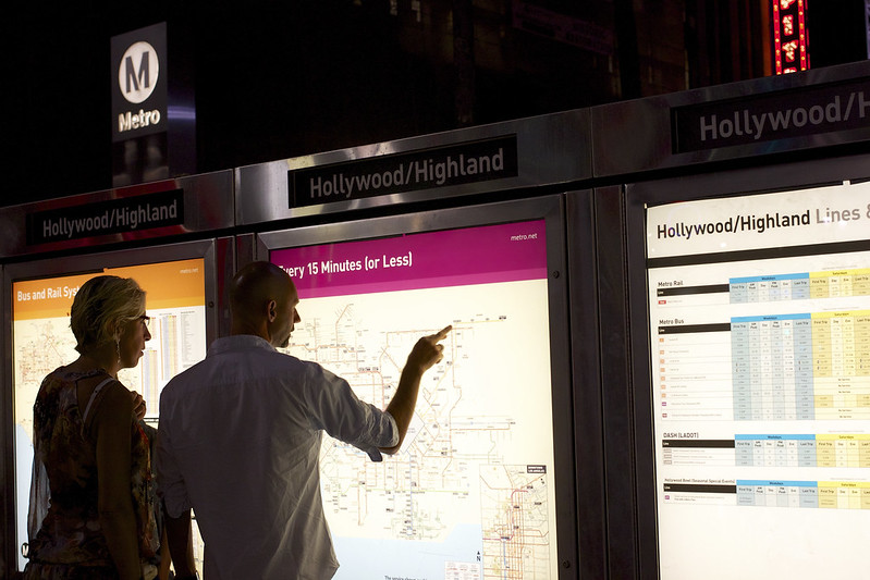 LA Metro 7 by chkamerica, on Flickr
LA Metro 7 by chkamerica, on Flickr- October 22nd, 2014, 6:15 pm
- Forum: Transportation
- Topic: Twin Cities Future Transit Map
- Replies: 377
- Views: 83387
- October 21st, 2014, 11:20 pm
- Forum: Transportation
- Topic: Twin Cities Future Transit Map
- Replies: 377
- Views: 83387
Re: Twin Cities Future Transit Map
The Orange line is currently shown as terminating at Government Plaza station but I believe there would be another terminal at Washington. Can anyone confirm?
- October 21st, 2014, 10:17 pm
- Forum: Transportation
- Topic: Twin Cities Future Transit Map
- Replies: 377
- Views: 83387
- October 21st, 2014, 10:03 pm
- Forum: Transportation
- Topic: Twin Cities Future Transit Map
- Replies: 377
- Views: 83387
Re: Twin Cities Future Transit Map
Do you think it may be silently protesting against the SWLRT tunnel?Lake of the isles looks like it's giving the rest of South Minneapolis the finger
- October 21st, 2014, 9:39 pm
- Forum: Transportation
- Topic: Twin Cities Future Transit Map
- Replies: 377
- Views: 83387
Re: Twin Cities Future Transit Map
A small update. The core network is basically in place: light rail, BRT, aBRT and hi-frequency routes here are complemented by less-frequent feeder routes. No infrequent limited and suburban express routes will be shown. Service frequency should really always be prioritized over transport modes. htt...
- October 21st, 2014, 8:54 pm
- Forum: Transportation
- Topic: Twin Cities Future Transit Map
- Replies: 377
- Views: 83387
Re: Twin Cities Future Transit Map
Makes sense. I twitted at Metro Transit earlier and got a response back that "there will be a branding discussion when arterial BRT is in service in multiple corridors"
"Gust" anyone?

"Gust" anyone?
- October 20th, 2014, 1:58 pm
- Forum: Transportation
- Topic: Twin Cities Future Transit Map
- Replies: 377
- Views: 83387
Re: Twin Cities Future Transit Map
Anyone know what Metrotransit decided to call the aBRT system?
- October 20th, 2014, 1:56 pm
- Forum: Transportation
- Topic: Twin Cities Future Transit Map
- Replies: 377
- Views: 83387
Re: Twin Cities Future Transit Map
They are just temporary placeholders. Color/symbols/type will be different on a final print.

- October 12th, 2014, 9:15 pm
- Forum: Transportation
- Topic: Twin Cities Future Transit Map
- Replies: 377
- Views: 83387
Re: Twin Cities Future Transit Map
Lake St. BRT and the Greenway streetcar lines. This is subject to change
- October 12th, 2014, 8:49 pm
- Forum: Transportation
- Topic: Twin Cities Future Transit Map
- Replies: 377
- Views: 83387
Re: Twin Cities Future Transit Map
Yes. The part that lies within city limits anyway.Will you be adding the Gateway Corridor as the Gold Line?


- October 12th, 2014, 7:56 pm
- Forum: Transportation
- Topic: Twin Cities Future Transit Map
- Replies: 377
- Views: 83387
Re: Twin Cities Future Transit Map
A small update: I'm re-mixing the map to show more services. This new version (top image) is built around a new 30-degree grid which is more geographically accurate than the old, more geometric map (bottom image): https://i.imgur.com/8ai1H02.png I'm also contemplating cutting out the suburbs altoget...
- September 14th, 2014, 2:24 pm
- Forum: Transportation
- Topic: Twin Cities Future Transit Map
- Replies: 377
- Views: 83387
Re: Twin Cities Future Transit Map
This new plan in Edina has a light rail in the renderings at Vernon and hwy 100. I'm on mobile now so can't make the map but they could have this go north south up to westend then to target field via cedar lake trail stopping at Penn too for people to transfer. Could stop at excelsior next to bunny...
- September 3rd, 2014, 9:20 pm
- Forum: Transportation
- Topic: Twin Cities Future Transit Map
- Replies: 377
- Views: 83387
- August 8th, 2014, 10:04 pm
- Forum: Transportation
- Topic: Twin Cities Future Transit Map
- Replies: 377
- Views: 83387
Re: Twin Cities Future Transit Map
I relocated to California for a wayfinding gig. Will try to update as soon as I've settled in.